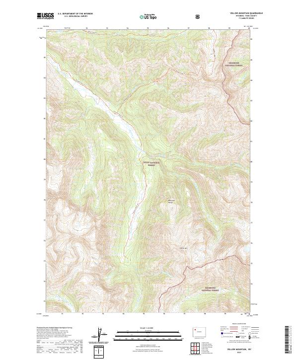
2021 Map of Yellow Mountain
USGS Topo · Published 2021About this map
The Absaroka Range dominates this high-altitude landscape in northwest Wyoming, where the headwaters of the N Fork Yellowstone River begin their descent. This 2021 survey documents the convergence of the Shoshone National Forest and Teton National Forest, a region defined by its lack of roads and reliance on historical trail networks. Notable peaks like Yellow Mountain rise above complex drainage systems including Thorofare Creek and Valley Fork. The map traces long-established routes such as the Thorofare River Trail and Woody Creek Trail, which follow the natural contours of the river valleys. These trails provide the primary means of navigating the backcountry near Esmond Forks and Bruin Creek, illustrating how the wilderness has remained largely unchanged since the earliest mountain men explored these forks.
Find a feature on this map
19 named features on this map. Tap any name to fly to it.
Don’t see what you’re looking for? This feature index may not catch every label — zoom into the map to look around manually.
Map Details
Editions of this 2021 Yellow Mountain Map
This is the sole edition of this map. No revisions or reprints were ever made.
Other maps of this area

1893 · Ishawooa
USGS Topo · 1:125,000

1895 · Ishawooa
USGS Topo · 1:125,000

1899 · Ishawooa
USGS Topo · 1:125,000

1905 · Younts Peak
USGS Topo · 1:125,000

1907 · Younts Peak
USGS Topo · 1:125,000

1955 · Cody
USGS Topo · 1:250,000

1955 · Thermopolis
USGS Topo · 1:250,000

1958 · Cody
USGS Topo · 1:250,000

1958 · Thermopolis
USGS Topo · 1:250,000

1962 · Thermopolis
USGS Topo · 1:250,000