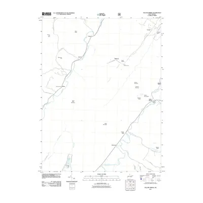
2011 Map of Yellow Spring
USGS Topo · Published 2011About this map
The Cacapon River and North River define the winding valleys of this Hampshire County landscape, where small rural communities are tucked between prominent ridges. The eponymous Yellow Spring and its nearby Yellow Spring Post Office serve as a focal point near Yellow Spring Gap, where the river cuts through the barrier of Cacapon Mountain. Genealogy researchers will find several well-placed burial grounds including Saint James Cemetery and Green Mount Cemetery, alongside historical post office locations like the one in Delray. The geography is shaped by steep elevations such as Baker Mountain and North River Mountain, which separate the river valleys. Local water management is evident at Warden Lake and the Elkhorn Lake Dam, while the presence of Davis Ford and various county highways indicates the persistent path of travel through this corner of West Virginia.
Find a feature on this map
48 named features on this map. Tap any name to fly to it.
Don’t see what you’re looking for? This feature index may not catch every label — zoom into the map to look around manually.
Map Details
Editions of this 2011 Yellow Spring Map
This is the sole edition of this map. No revisions or reprints were ever made.
Other maps of this area

1891 · Romney
USGS Topo · 1:125,000

1894 · Winchester
USGS Topo · 1:125,000

1916 · Capon Bridge
USGS Topo · 1:62,500

1921 · Hanging Rock
USGS Topo · 1:48,000

1922 · Wardensville
USGS Topo · 1:62,500

1923 · Middletown
USGS Topo · 1:62,500

1923 · Capon Bridge
USGS Topo · 1:62,500

1923 · Hanging Rock
USGS Topo · 1:62,500

1924 · Wardensville
USGS Topo · 1:62,500

1937 · Capon Bridge
USGS Topo · 1:48,000