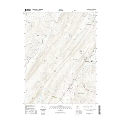
2014 Map of Yellow Spring
USGS Topo · Published 2014About this map
Yellow Spring and the surrounding Allegheny Mountains define this section of the Potomac Highlands, where the Cacapon River and North River carve deep valleys through the ridges. This 2014 survey documents the enduring rural character of small unincorporated communities like Sedan, Delray, and Intermont. The landscape is a network of ridges such as Cacapon Mtn and Baker Mtn, interspersed with family and community landmarks including the Hebron Lutheran Church Cem and Saint James Cem. Settlement patterns remain tied to the narrow valley floors, with Warden Lake providing a significant water feature in the southern portion of the quadrangle. Significant river crossings and mountain passes are identified, including the Kenneth Seldon Bridge and the Yellow Spring Gap, illustrating the historical transit routes through this complex terrain between Hampshire CO and Hardy CO.
Find a feature on this map
92 named features on this map. Tap any name to fly to it.
Don’t see what you’re looking for? This feature index may not catch every label — zoom into the map to look around manually.
Map Details
Editions of this 2014 Yellow Spring Map
This is the sole edition of this map. No revisions or reprints were ever made.
Other maps of this area

1891 · Romney
USGS Topo · 1:125,000

1894 · Winchester
USGS Topo · 1:125,000

1916 · Capon Bridge
USGS Topo · 1:62,500

1921 · Hanging Rock
USGS Topo · 1:48,000

1922 · Wardensville
USGS Topo · 1:62,500

1923 · Middletown
USGS Topo · 1:62,500

1923 · Capon Bridge
USGS Topo · 1:62,500

1923 · Hanging Rock
USGS Topo · 1:62,500

1924 · Wardensville
USGS Topo · 1:62,500

1937 · Capon Bridge
USGS Topo · 1:48,000