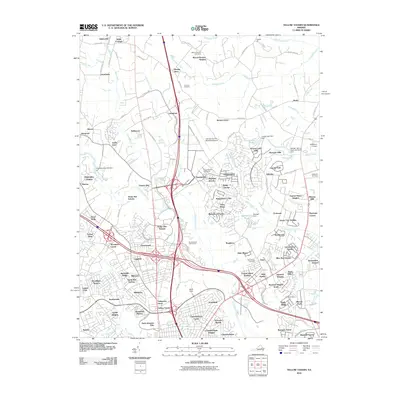
2010 Map of Yellow Tavern
USGS Topo · Published 2010About this map
Yellow Tavern serves as a central landmark in this 2010 depiction of Hanover County, where the infrastructure of the CSX railroad and modern highway interchanges meets deep-rooted Virginia settlements. The landscape is characterized by its transition from suburban residential clusters like Greenwood and Ashcake to more established sites such as Saint Josephs Villa. The map records several legacy locations that speak to the area's agricultural and industrial past, including the Chickahominy Mill Dam on the Chickahominy River and family-named landmarks like Berkeleys Store. Aviation plays a notable role in the local geography, with both the Hanover County Municipal Airport and the smaller Robertson Airport serving the region. Waterways such as Stony Run and Totopotomoy Creek drain the terrain, which is dotted with numerous small dams and named ponds like Forest Hills Lake, indicating the long-term management of the local watershed for both aesthetic and utility purposes.
Find a feature on this map
146 named features on this map. Tap any name to fly to it.
Don’t see what you’re looking for? This feature index may not catch every label — zoom into the map to look around manually.
Map Details
Editions of this 2010 Yellow Tavern Map
This is the sole edition of this map. No revisions or reprints were ever made.
Other maps of this area

1890 · Goochland
USGS Topo · 1:125,000

1892 · Goochland
USGS Topo · 1:125,000

1894 · Richmond
USGS Topo · 1:62,500

1895 · Richmond
USGS Topo · 1:62,500

1918 · Doswell
USGS Topo · 1:62,500

1934 · Seven Pines
USGS Topo · 1:24,000

1934 · Richmond
USGS Topo · 1:24,000

1936 · Richmond West
USGS Topo · 1:24,000

1936 · Glen Allen
USGS Topo · 1:24,000

1938 · Seven Pines
USGS Topo · 1:31,680