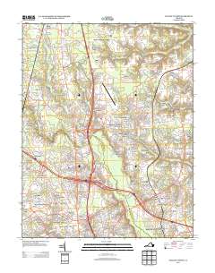
2013 Map of Yellow Tavern
USGS Topo · Published 2013About this map
Yellow Tavern and the surrounding Hanover County landscape are captured in this 2013 survey, reflecting a transition from rural crossroads to suburban development. The Chickahominy River flows through the central portion of the map, while Totopotomoy Cr and Mechumps Cr drain the northern reaches. This era shows the established presence of the Hanover County Municipal Airport and the complex infrastructure of the CSX Transportation rail lines. Historically significant locations such as Slash Cottage and French Hay remain marked, alongside several local landmarks like Heaths Store and Solomons Store. The map illustrates the residential growth of neighborhoods including Stonewall Manor, Lydell Heights, and Saint Josephs Villa, showing how modern subdivisions have filled the spaces between older settlements like Elmont, Gwathmey, and Lewistown.
Find a feature on this map
259 named features on this map. Tap any name to fly to it.
Don’t see what you’re looking for? This feature index may not catch every label — zoom into the map to look around manually.
Map Details
Editions of this 2013 Yellow Tavern Map
This is the sole edition of this map. No revisions or reprints were ever made.
Other maps of this area

1890 · Goochland
USGS Topo · 1:125,000

1892 · Goochland
USGS Topo · 1:125,000

1894 · Richmond
USGS Topo · 1:62,500

1895 · Richmond
USGS Topo · 1:62,500

1918 · Doswell
USGS Topo · 1:62,500

1934 · Seven Pines
USGS Topo · 1:24,000

1934 · Richmond
USGS Topo · 1:24,000

1936 · Richmond West
USGS Topo · 1:24,000

1936 · Glen Allen
USGS Topo · 1:24,000

1938 · Seven Pines
USGS Topo · 1:31,680