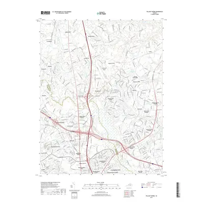
2019 Map of Yellow Tavern
USGS Topo · Published 2019About this map
Ashcake Rd and several major transportation corridors anchor this landscape at the boundary of Hanover and Henrico counties. The southern reaches of Ashland and the growing residential pockets of Glen Allen dominate the area, while the Hanover County Municipal Airport serves as a modern landmark north of Poindexters. Local history is preserved in small family and community anchors such as Heaths Store, Solomons Store, and the Gwathmey Church. The terrain is defined by a dense network of tributaries including Totopotomoy Cr and Mechumps Cr that feed into the Chickahominy River. This modern topographic survey captures the transition from established railroad-era settlements like Gwathmey and Elmont to suburban developments such as Laurel Grove Estates and Craney Island Estates.
Find a feature on this map
300 named features on this map. Tap any name to fly to it.
Don’t see what you’re looking for? This feature index may not catch every label — zoom into the map to look around manually.
Map Details
Editions of this 2019 Yellow Tavern Map
This is the sole edition of this map. No revisions or reprints were ever made.
Other maps of this area

1890 · Goochland
USGS Topo · 1:125,000

1892 · Goochland
USGS Topo · 1:125,000

1894 · Richmond
USGS Topo · 1:62,500

1895 · Richmond
USGS Topo · 1:62,500

1918 · Doswell
USGS Topo · 1:62,500

1934 · Seven Pines
USGS Topo · 1:24,000

1934 · Richmond
USGS Topo · 1:24,000

1936 · Richmond West
USGS Topo · 1:24,000

1936 · Glen Allen
USGS Topo · 1:24,000

1938 · Seven Pines
USGS Topo · 1:31,680