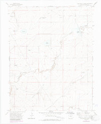
1970 Map of Yellowbank Creek
USGS Topo · Published 1985About this map
Yellowbank Creek and its neighboring drainage systems define this section of the Colorado high plains, captured here through aerial photography from the late 1960s and updated in the mid-1980s. The landscape is heavily marked by ranching and resource management, evidenced by numerous named reservoirs including Bombing Range Reservoir, Schoolhouse Reservoir, and Stauder Reservoir. These water features, alongside a network of family-named windmills like Weinegar Windmill and Derringer Windmill, suggest a reliance on subsurface water to support livestock in a dry environment. The presence of Dry Lake further emphasizes the seasonal nature of the local hydrology. Industrial activity is indicated at the southern edge of the sheet by the Big Pit, while landmarks like Wonder and Mustang Creek provide geographic orientation for researchers tracking local land-use patterns or family holdings.
Find a feature on this map
27 named features on this map. Tap any name to fly to it.
Don’t see what you’re looking for? This feature index may not catch every label — zoom into the map to look around manually.
Map Details
Editions of this 1970 Yellowbank Creek Map
4 editions found
Other maps of this area

1891 · Nepesta
USGS Topo · 1:125,000

1891 · Apishapa
USGS Topo · 1:125,000

1893 · Nepesta
USGS Topo · 1:125,000

1893 · Apishapa
USGS Topo · 1:125,000

1897 · Apishapa
USGS Topo · 1:125,000

1904 · Nepesta
USGS Topo · 1:125,000

1954 · Trinidad
USGS Topo · 1:250,000

1954 · Pueblo
USGS Topo · 1:250,000

1955 · Trinidad
USGS Topo · 1:250,000

1957 · Pueblo
USGS Topo · 1:250,000