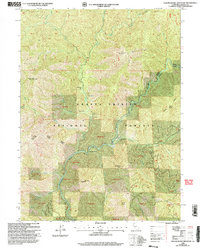
1998 Map of Yellowjacket Mountain
USGS Topo · Published 2003About this map
McCloud River dominates the center of this landscape, carving a deep canyon through the heart of the Shasta - Trinity National Forests. This late-1990s revision reveals a terrain defined by named flats and sharp peaks, where the Mc Cloud Ranger District manages the steep timberlands. The river is the primary corridor for human activity, marked by the McCloud River Club and the sharp oxbow at Hamilton Bend. Higher elevations are punctuated by family or descriptive landmarks like Yellowjacket Mountain, Hat Mountain, and Satin Peak. The mapping of various numbered tracts, such as Tract 39 and Tract 41, suggests the complexity of public and private land management within the national forest system, while isolated clearings like Peterson Flat and Two Pine Flat break the dense forest cover.
Find a feature on this map
40 named features on this map. Tap any name to fly to it.
Don’t see what you’re looking for? This feature index may not catch every label — zoom into the map to look around manually.
Map Details
Editions of this 1998 Yellowjacket Mountain Map
2 editions found
Other maps of this area

1886 · Shasta
USGS Topo · 1:250,000

1890 · Red Bluff
USGS Topo · 1:250,000

1894 · Red Bluff
USGS Topo · 1:250,000

1894 · Shasta
USGS Topo · 1:250,000

1901 · Redding
USGS Topo · 1:125,000

1935 · Dunsmuir
USGS Topo · 1:125,000

1946 · Lamoine
USGS Topo · 1:62,500

1948 · Weed
USGS Topo · 1:250,000

1949 · Bollibokka Mtn
USGS Topo · 1:62,500

1950 · Weed
USGS Topo · 1:250,000