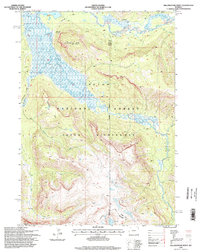
1996 Map of Yellowstone Point
USGS Topo · Published 1998About this map
The Teton Wilderness and Teton National Forest define this high-altitude landscape, where the Continental Divide winds through the southern reaches. This area is characterized by the confluence of the Yellowstone River and the Thorofare River, creating a network of riparian basins and drainages including Seneca Creek and Castle Creek. Remote administrative markers like the Hawks Rest Patrol Cabin and the FS Radio Repeater near Hawks Rest indicate the light human footprint in this backcountry region during the mid-1990s. Long-established routes such as the Thorofare Trail and the Atlantic-Pacific Trail skirt the edges of peaks like Yellowstone Point, following natural corridors used by generations of travelers crossing into the high country. The map also captures an Indefinite Boundary and the convergence of several county lines at Tri-county Lake, reflecting the complexities of mapping this difficult terrain.
Find a feature on this map
20 named features on this map. Tap any name to fly to it.
Don’t see what you’re looking for? This feature index may not catch every label — zoom into the map to look around manually.
Map Details
Editions of this 1996 Yellowstone Point Map
This is the sole edition of this map. No revisions or reprints were ever made.
Other maps of this area

1885 · Lake
USGS Topo · 1:125,000

1893 · Ishawooa
USGS Topo · 1:125,000

1895 · Ishawooa
USGS Topo · 1:125,000

1895 · Lake
USGS Topo · 1:125,000

1896 · Lake
USGS Topo · 1:125,000

1899 · Ishawooa
USGS Topo · 1:125,000

1901 · Lake
USGS Topo · 1:125,000

1902 · Mt Leidy
USGS Topo · 1:125,000

1905 · Younts Peak
USGS Topo · 1:125,000

1906 · Lake
USGS Topo · 1:125,000