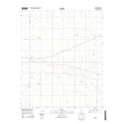
2013 Map of Yeso
USGS Topo · Published 2013About this map
Yeso serves as the primary hub of this high plains landscape in De Baca County, concentrated around the corridor of Us-60 E. The settlement is anchored by a local Po and is surrounded by a network of county roads that connect remote homesteads and grazing lands. The grid-like survey lines of t3n r22e and t2n r23e organize the territory, which includes the small community of Evanola and established agricultural outposts like Hisel Ranch and Long Ranch. For those researching local family history, the Yeso Cem is clearly marked south of the main town site. The landscape is defined by its infrastructure of named routes such as Dunlap Rd and Angus Rd, illustrating the spatial relationship between these isolated rural settlements and the vital East-West highway that links them.
Find a feature on this map
18 named features on this map. Tap any name to fly to it.
Don’t see what you’re looking for? This feature index may not catch every label — zoom into the map to look around manually.
Map Details
Editions of this 2013 Yeso Map
This is the sole edition of this map. No revisions or reprints were ever made.
Other maps of this area

1954 · Fort Sumner
USGS Topo · 1:250,000

1958 · Fort Sumner
USGS Topo · 1:250,000

1966 · West Camp
USGS Topo · 1:24,000

1966 · El Morro Mesa
USGS Topo · 1:24,000

1966 · Ricardo
USGS Topo · 1:24,000

1966 · Alamogordo Dam
USGS Topo · 1:24,000

1966 · Borica SW
USGS Topo · 1:24,000

1966 · Cooper Ranch
USGS Topo · 1:24,000

1966 · Horney Ranch
USGS Topo · 1:24,000

1966 · Yeso
USGS Topo · 1:24,000