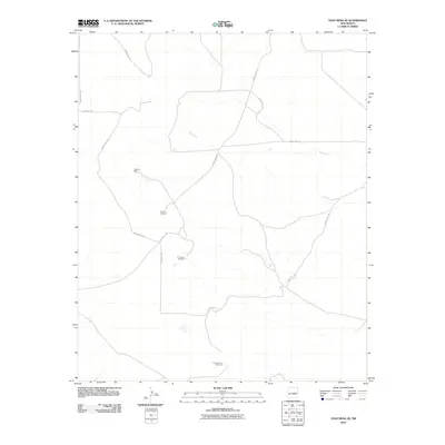
2010 Map of Yeso Mesa SE
USGS Topo · Published 2010About this map
Yeso Creek winds through this arid section of De Baca County, defining the drainage patterns of a landscape dedicated to cattle ranching. The 2010 survey highlights a network of essential water infrastructure, including Johnson Well and Canyon Windmill, which are critical for livestock in this high-desert environment. This mapping illustrates how land use is organized around these scattered water sources and a sparse grid of rural routes such as County Rd-1-45 and the descriptively named Washout Rd. Further south, C C Camp Windmill and East Pasture Windmill mark distinct grazing divisions, providing a clear view of the modern ranching economy and the enduring reliance on groundwater in eastern New Mexico.
Find a feature on this map
13 named features on this map. Tap any name to fly to it.
Don’t see what you’re looking for? This feature index may not catch every label — zoom into the map to look around manually.
Map Details
Editions of this 2010 Yeso Mesa SE Map
This is the sole edition of this map. No revisions or reprints were ever made.
Other maps of this area

1954 · Fort Sumner
USGS Topo · 1:250,000

1958 · Fort Sumner
USGS Topo · 1:250,000

1966 · El Morro Mesa
USGS Topo · 1:24,000

1966 · Yeso NW
USGS Topo · 1:24,000

1967 · Ramon
USGS Topo · 1:24,000
1967 · The Old Dry Lake
USGS Topo · 1:24,000

1967 · Wright Ranch
USGS Topo · 1:24,000

1979 · Fort Sumner
USGS Topo · 1:100,000

1981 · Loco Draw
USGS Topo · 1:24,000

1981 · Yeso Mesa
USGS Topo · 1:24,000