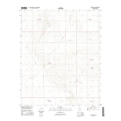
2017 Map of Yeso Mesa SE
USGS Topo · Published 2017About this map
Yeso Cr winds through this arid section of De Baca County, carving a drainage pattern across a landscape defined by ranch roads and wide basins. The mapping reflects a region where water management is critical for land use, evidenced by features like Breaks Tank. To the southeast, the terrain opens into Gramma Valley, while Turner Draw marks the southern reaches of the quadrangle. A network of rural tracks, including Red Horse Rd, Tincup Rd, and Washout Rd, provides access across the township and range boundaries of the Public Land Survey System. This modern survey captures the enduring spatial organization of New Mexico’s high plains, where named topographical features often serve as the primary landmarks for navigation and land management.
Find a feature on this map
16 named features on this map. Tap any name to fly to it.
Don’t see what you’re looking for? This feature index may not catch every label — zoom into the map to look around manually.
Map Details
Editions of this 2017 Yeso Mesa SE Map
This is the sole edition of this map. No revisions or reprints were ever made.
Other maps of this area

1954 · Fort Sumner
USGS Topo · 1:250,000

1958 · Fort Sumner
USGS Topo · 1:250,000

1966 · El Morro Mesa
USGS Topo · 1:24,000

1966 · Yeso NW
USGS Topo · 1:24,000

1967 · Ramon
USGS Topo · 1:24,000
1967 · The Old Dry Lake
USGS Topo · 1:24,000

1967 · Wright Ranch
USGS Topo · 1:24,000

1979 · Fort Sumner
USGS Topo · 1:100,000

1981 · Loco Draw
USGS Topo · 1:24,000

1981 · Yeso Mesa
USGS Topo · 1:24,000