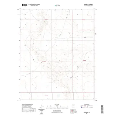
2020 Map of Yeso Mesa SE
USGS Topo · Published 2020About this map
Gramma Valley dominates the eastern half of this terrain in De Baca County, characterized by the drainage patterns of Yeso Cr as it flows eastward across the landscape. The environment is defined by extensive ranching infrastructure, where water sources like Breaks Tank provide essential relief in an arid geography. The southern reaches are marked by the seasonal drainage of Turner Draw, while the entire area is stitched together by a functional network of local routes including S Border Rd, Red Horse Rd, and Washout Rd. These features reflect a land use focused on livestock and resource management, with topographic variations clearly delineating the mesas and lowlands typical of this New Mexico region. The township and range boundaries further organize the vast open space, providing a framework for understanding the cadastral history of the high plains.
Find a feature on this map
16 named features on this map. Tap any name to fly to it.
Don’t see what you’re looking for? This feature index may not catch every label — zoom into the map to look around manually.
Map Details
Editions of this 2020 Yeso Mesa SE Map
This is the sole edition of this map. No revisions or reprints were ever made.
Other maps of this area

1954 · Fort Sumner
USGS Topo · 1:250,000

1958 · Fort Sumner
USGS Topo · 1:250,000

1966 · El Morro Mesa
USGS Topo · 1:24,000

1966 · Yeso NW
USGS Topo · 1:24,000

1967 · Ramon
USGS Topo · 1:24,000
1967 · The Old Dry Lake
USGS Topo · 1:24,000

1967 · Wright Ranch
USGS Topo · 1:24,000

1979 · Fort Sumner
USGS Topo · 1:100,000

1981 · Loco Draw
USGS Topo · 1:24,000

1981 · Yeso Mesa
USGS Topo · 1:24,000