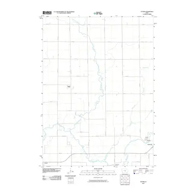
2010 Map of Yetter
USGS Topo · Published 2010About this map
Lake City anchors the southeast corner of this Calhoun County landscape, where the town's grid meets the wandering path of Lake Creek. The area is defined by a dense network of sectional roads such as Dakota Ave and 330th St, reflecting the disciplined agricultural layout of the Iowa plains. Near the center of the sheet, the small settlement of Yetter sits as a quiet rail-era outpost, while Auburn appears along the southern edge near the North Raccoon River. Significant local history is preserved in the placement of rural burial grounds, including the Cottonwood Cemetery and the adjacent Lake City Cemetery and Saint Mary's Cemetery on the outskirts of town. Waterways like Camp Creek and the West Fork Camp Creek cut diagonally across the survey, providing the only departures from the rigid cardinal-direction road system.
Find a feature on this map
33 named features on this map. Tap any name to fly to it.
Don’t see what you’re looking for? This feature index may not catch every label — zoom into the map to look around manually.
Map Details
Editions of this 2010 Yetter Map
This is the sole edition of this map. No revisions or reprints were ever made.
Other maps of this area

1954 · Fort Dodge
USGS Topo · 1:250,000

1957 · Fort Dodge
USGS Topo · 1:250,000

1958 · Fort Dodge
USGS Topo · 1:250,000

1980 · Lytton
USGS Topo · 1:24,000

1980 · Rockwell City
USGS Topo · 1:24,000

1980 · Sac City East
USGS Topo · 1:24,000

1980 · Breda
USGS Topo · 1:24,000

1980 · Grant City
USGS Topo · 1:24,000

1980 · Carroll NE
USGS Topo · 1:24,000

1980 · Yetter
USGS Topo · 1:24,000