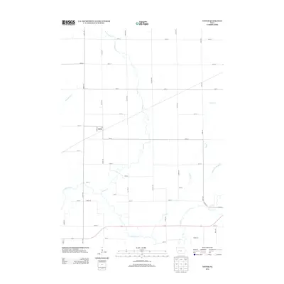
2013 Map of Yetter
USGS Topo · Published 2013About this map
Yetter stands as the primary settlement in this section of Calhoun County, positioned within a grid of rural roads such as Dakota Ave and Elkland Ave. The landscape is defined by its agricultural drainage and natural water systems, most notably the winding path of the N Raccoon River in the southern portion of the quadrangle. Several significant tributaries converge or traverse the area, including Camp Cr, Prairie Cr, and Lake Cr.
Find a feature on this map
37 named features on this map. Tap any name to fly to it.
Don’t see what you’re looking for? This feature index may not catch every label — zoom into the map to look around manually.
Map Details
Editions of this 2013 Yetter Map
This is the sole edition of this map. No revisions or reprints were ever made.
Other maps of this area

1954 · Fort Dodge
USGS Topo · 1:250,000

1957 · Fort Dodge
USGS Topo · 1:250,000

1958 · Fort Dodge
USGS Topo · 1:250,000

1980 · Lytton
USGS Topo · 1:24,000

1980 · Rockwell City
USGS Topo · 1:24,000

1980 · Sac City East
USGS Topo · 1:24,000

1980 · Breda
USGS Topo · 1:24,000

1980 · Grant City
USGS Topo · 1:24,000

1980 · Carroll NE
USGS Topo · 1:24,000

1980 · Yetter
USGS Topo · 1:24,000