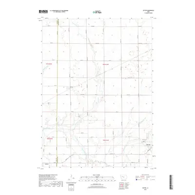
2018 Map of Yetter
USGS Topo · Published 2018About this map
Yetter sits at the intersection of Durant Ave and 330th St, anchoring a landscape defined by the agricultural grid of western Iowa. This 2018 survey reveals the intricate water management system essential to the region's productivity, featuring prominent waterways like the North Raccoon River and man-made channels such as Drainage Ditch 31 and Drainage Ditch 198. The map traces the border between Sac and Calhoun counties, illustrating how political boundaries and section lines align with the local road network.
Find a feature on this map
46 named features on this map. Tap any name to fly to it.
Don’t see what you’re looking for? This feature index may not catch every label — zoom into the map to look around manually.
Map Details
Editions of this 2018 Yetter Map
This is the sole edition of this map. No revisions or reprints were ever made.
Other maps of this area

1954 · Fort Dodge
USGS Topo · 1:250,000

1957 · Fort Dodge
USGS Topo · 1:250,000

1958 · Fort Dodge
USGS Topo · 1:250,000

1980 · Lytton
USGS Topo · 1:24,000

1980 · Rockwell City
USGS Topo · 1:24,000

1980 · Sac City East
USGS Topo · 1:24,000

1980 · Breda
USGS Topo · 1:24,000

1980 · Grant City
USGS Topo · 1:24,000

1980 · Carroll NE
USGS Topo · 1:24,000

1980 · Yetter
USGS Topo · 1:24,000