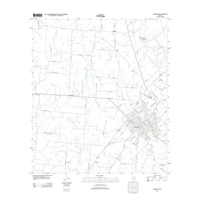
2013 Map of Yoakum
USGS Topo · Published 2013About this map
The city of Yoakum serves as the central hub of this South Texas landscape, where a dense grid of residential streets transitions into a sprawling network of ranch roads and rural homesteads. The local economy and infrastructure are clearly defined by the South Yoakum Oil Field to the south and the Yoakum Municipal Airport to the east, reflecting the region's industrial and aviation history. For genealogists and local historians, several burial sites are recorded across the terrain, including Saint Joseph Cem near the city center and the more isolated Sons of Herman Cem and Teppim Cem in the surrounding countryside.
Find a feature on this map
132 named features on this map. Tap any name to fly to it.
Don’t see what you’re looking for? This feature index may not catch every label — zoom into the map to look around manually.
Map Details
Editions of this 2013 Yoakum Map
This is the sole edition of this map. No revisions or reprints were ever made.
Other maps of this area

1953 · Seguin
USGS Topo · 1:250,000

1958 · Seguin
USGS Topo · 1:250,000

1959 · Hochheim
USGS Topo · 1:24,000

1959 · Hamon
USGS Topo · 1:24,000

1960 · Concrete
USGS Topo · 1:24,000

1962 · Edgar
USGS Topo · 1:24,000

1962 · Terryville
USGS Topo · 1:24,000

1963 · Yoakum
USGS Topo · 1:24,000

1963 · Sweet Home
USGS Topo · 1:24,000

1965 · Wied
USGS Topo · 1:24,000