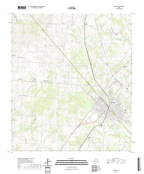
2022 Map of Yoakum
USGS Topo · Published 2022About this map
The city of Yoakum straddles the boundary between Lavaca and DeWitt counties, serving as a hub of commerce and community in this region of South Texas. The landscape is defined by the winding course of Big Brushy Creek and its tributaries, including Little Brushy Creek and McCoy Creek, which drain the surrounding agricultural lands. Notable for its density of community landmarks, the area features numerous local burial grounds such as the Sons of Herman Cemetery and Allen Family Cemetery, reflecting generations of family settlement. Smaller outlying communities like Pearl City and Petersville are connected to the urban center by a network of farm-to-market roads. To the northeast, the terrain rises toward the feature known as Supplejack, while local aviation is supported by Yoakum Municipal Airport and the Pearson Ranch Private Airport near Midway.
Find a feature on this map
152 named features on this map. Tap any name to fly to it.
Don’t see what you’re looking for? This feature index may not catch every label — zoom into the map to look around manually.
Map Details
Editions of this 2022 Yoakum Map
This is the sole edition of this map. No revisions or reprints were ever made.
Other maps of this area

1953 · Seguin
USGS Topo · 1:250,000

1958 · Seguin
USGS Topo · 1:250,000

1959 · Hochheim
USGS Topo · 1:24,000

1959 · Hamon
USGS Topo · 1:24,000

1960 · Concrete
USGS Topo · 1:24,000

1962 · Edgar
USGS Topo · 1:24,000

1962 · Terryville
USGS Topo · 1:24,000

1963 · Yoakum
USGS Topo · 1:24,000

1963 · Sweet Home
USGS Topo · 1:24,000

1965 · Wied
USGS Topo · 1:24,000