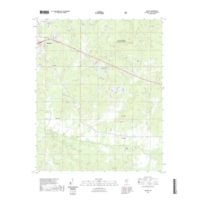
2021 Map of Yocona
USGS Topo · Published 2021About this map
Oxford's southeastern reaches give way to a densely wooded and creek-carved landscape within the Holly Springs National Forest. The southern portion of the map is dominated by the Yocona River floodplain, where numerous tributaries like Potlockney Cr and Hartsfield Br converge. This area reflects a long-standing rural settlement pattern characterized by small, family-named landmarks and historical burial grounds such as Kingdom Cem and Bowles Cem.
Find a feature on this map
92 named features on this map. Tap any name to fly to it.
Don’t see what you’re looking for? This feature index may not catch every label — zoom into the map to look around manually.
Map Details
Editions of this 2021 Yocona Map
This is the sole edition of this map. No revisions or reprints were ever made.
Other maps of this area

1940 · Oxford
USGS Topo · 1:62,500

1942 · Denmark
USGS Topo · 1:62,500

1943 · Denmark
USGS Topo · 1:62,500

1943 · Oxford
USGS Topo · 1:62,500

1954 · Water Valley
USGS Topo · 1:62,500

1955 · Water Valley
USGS Topo · 1:62,500

1956 · Tupelo
USGS Topo · 1:250,000

1958 · Tupelo
USGS Topo · 1:250,000

1972 · Paris
USGS Topo · 1:24,000
1972 · Tula
USGS Topo · 1:24,000