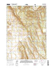
2017 Map of Yonna
USGS Topo · Published 2017About this map
The high plateau of Klamath County is defined by the rugged interface of volcanic ridges and drainage basins, most notably where Yainax Ridge and Bly Mtn overlook the surrounding flats. The settlement of Hildebrand serves as a local anchor near the westward-flowing Wildhorse Cr, while the community of Yonna sits further south near Short Lake Mtn. This landscape is heavily managed for water, evidenced by Ritter Reservoir, Cox Reservoir, and several remote springs like Boundary Spring and Calohan Spring. High-elevation passage is marked by Bly Mountain Pass, a critical transition point through the timbered slopes of the Winema National Forest. The map also details a dense network of forest and county roads, including Co HWY 1101 and Yonna Loop DR, which connect the scattered agricultural and residential outposts across this interior Oregon terrain.
Find a feature on this map
113 named features on this map. Tap any name to fly to it.
Don’t see what you’re looking for? This feature index may not catch every label — zoom into the map to look around manually.
Map Details
Editions of this 2017 Yonna Map
This is the sole edition of this map. No revisions or reprints were ever made.
Other maps of this area

1889 · Klamath
USGS Topo · 1:250,000

1894 · Klamath
USGS Topo · 1:250,000

1955 · Klamath Falls
USGS Topo · 1:250,000

1957 · Merrill
USGS Topo · 1:62,500

1957 · Swan Lake
USGS Topo · 1:62,500

1957 · Malin
USGS Topo · 1:62,500

1958 · Klamath Falls
USGS Topo · 1:250,000

1960 · Beatty
USGS Topo · 1:62,500
1985 · Dairy
USGS Topo · 1:24,000
1985 · Sprague River West
USGS Topo · 1:24,000