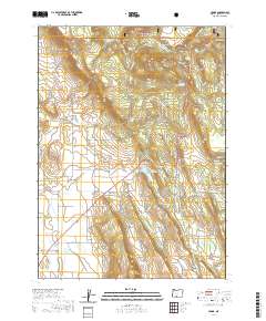
2020 Map of Yonna
USGS Topo · Published 2020About this map
Hildebrand sits at the base of the high desert slopes in this Klamath County study, where the eastern edge of the Winema National Forest meets a landscape defined by water management and transit routes. The geography is shaped by the volcanic rise of Bly Mtn, which is crossed at Bly Mountain Pass by the local highway system. This transition from forest to flatland is evidenced by the numerous water features critical to the region's ranching or agricultural heritage, including Ritter Reservoir, Cox Reservoir, and Johnny Lake.
Find a feature on this map
111 named features on this map. Tap any name to fly to it.
Don’t see what you’re looking for? This feature index may not catch every label — zoom into the map to look around manually.
Map Details
Editions of this 2020 Yonna Map
This is the sole edition of this map. No revisions or reprints were ever made.
Other maps of this area

1889 · Klamath
USGS Topo · 1:250,000

1894 · Klamath
USGS Topo · 1:250,000

1955 · Klamath Falls
USGS Topo · 1:250,000

1957 · Merrill
USGS Topo · 1:62,500

1957 · Swan Lake
USGS Topo · 1:62,500

1957 · Malin
USGS Topo · 1:62,500

1958 · Klamath Falls
USGS Topo · 1:250,000

1960 · Beatty
USGS Topo · 1:62,500
1985 · Dairy
USGS Topo · 1:24,000
1985 · Sprague River West
USGS Topo · 1:24,000