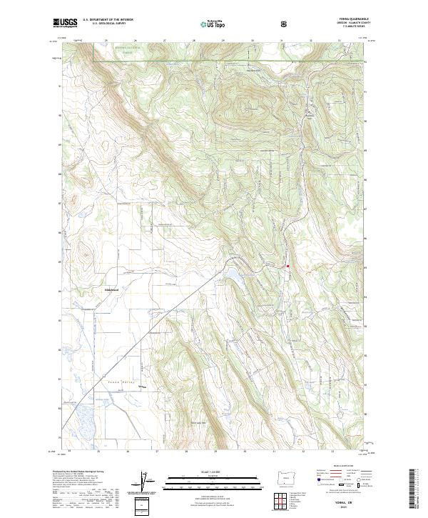
2023 Map of Yonna
USGS Topo · Published 2023About this map
The Yonna Valley defines the lower-elevation reaches of this Klamath County landscape, where the small settlements of Hildebrand and Yonna reside along the valley floor. To the north, the terrain climbs steeply toward the crest of Bly Mtn, which is traversed by the Bly Mountain Pass. This area marks a transition from open valley agriculture and ranching to the timbered slopes of the Winema National Forest, which covers the northern portion of the quadrangle. Water management is a central theme of the local geography, visible in the network of reservoirs and small lakes such as Ritter Reservoir, Cox Reservoir, and Johnny Lake. The drainage of Wildhorse Creek cuts through Wildhorse Canyon, while numerous springs like Boundary Spring and Callahan Spring provide reliable water sources in an otherwise seasonally dry environment. The dense network of modern residential road names on the higher plateaus suggests contemporary rural development overlooking the traditional valley homesteads.
Find a feature on this map
116 named features on this map. Tap any name to fly to it.
Don’t see what you’re looking for? This feature index may not catch every label — zoom into the map to look around manually.
Map Details
Editions of this 2023 Yonna Map
This is the sole edition of this map. No revisions or reprints were ever made.
Other maps of this area

1889 · Klamath
USGS Topo · 1:250,000

1894 · Klamath
USGS Topo · 1:250,000

1955 · Klamath Falls
USGS Topo · 1:250,000

1957 · Merrill
USGS Topo · 1:62,500

1957 · Swan Lake
USGS Topo · 1:62,500

1957 · Malin
USGS Topo · 1:62,500

1958 · Klamath Falls
USGS Topo · 1:250,000

1960 · Beatty
USGS Topo · 1:62,500
1985 · Dairy
USGS Topo · 1:24,000
1985 · Sprague River West
USGS Topo · 1:24,000