Loading...
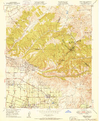
Loading map...1964 Map of Yorba Linda
USGS Topo · Published 1982About this map
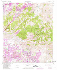
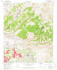
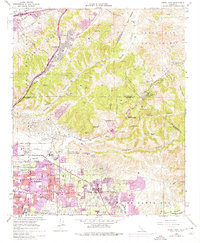
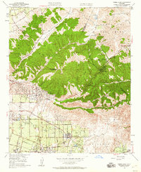
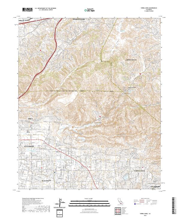
Placentia and Yorba Linda anchor this landscape during a period of rapid suburban expansion in Orange County. The 1978-era urban growth, marked in purple, pushes into the Puente Hills and Chino Hills, contrasting with the extensive Oil Field operations and citrus heritage of the Ca&on De Santa Ana. While new residential tracts fill the valleys, older landmarks like the La Vida Mineral Springs and the Robert Diemer Filtration Plant remain central to the local geography.
Find a feature on this map
48 named features on this map. Tap any name to fly to it.
Don’t see what you’re looking for? This feature index may not catch every label — zoom into the map to look around manually.
Map Details
Date Portrayed1964
Date Published1982
PublisherU.S. Geological Survey
Map TypeTopographic
Scale1:24,000
Physical Dimensions22 x 26.7 inches
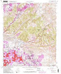
Editions of this 1964 Yorba Linda Map
3 editions found
Historical Maps of Anaheim Through Time
8 maps found
Featured Locations
Source Details
SourceU.S. Geological Survey
CopyrightPublic Domain