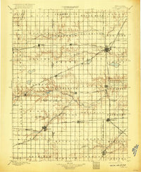
1898 Map of York
USGS Topo · Published 1917About this map
York and Geneva serve as primary hubs in this late-19th-century survey of the Nebraska plains, where a complex lattice of railroads defines the settlement pattern. The landscape is dominated by the expansive Burlington and Missouri River RR and the Kansas City and Omaha RR, which connect agricultural centers like Sutton and Fairmont. These rail lines were the lifeblood of the prairie economy, dictated by the placement of grain elevators and depots in towns such as Bradshaw, Henderson, and Grafton. Between these industrial corridors, the terrain is drained by the Big Blue River and the West Fork Big Blue River, with Turkey Creek carving through the southern reaches. The map captures a moment before modern consolidation, preserving the location of smaller crossroads and vanished points like Stockham, Saronville, and Sawyer, which once anchored the surrounding farmsteads.
Find a feature on this map
66 named features on this map. Tap any name to fly to it.
Don’t see what you’re looking for? This feature index may not catch every label — zoom into the map to look around manually.
Map Details
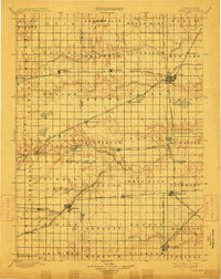
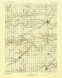
Editions of this 1898 York Map
4 editions found
Other maps of this area

1896 · Stromsburg
USGS Topo · 1:125,000

1898 · York
USGS Topo · 1:125,000

1898 · Superior
USGS Topo · 1:125,000

1898 · Hebron
USGS Topo · 1:125,000

1898 · Grand Island
USGS Topo · 1:125,000

1899 · David City
USGS Topo · 1:125,000

1899 · St. Paul
USGS Topo · 1:125,000

1899 · York
USGS Topo · 1:125,000

1934 · Utica
USGS Topo · 1:62,500

1937 · Utica
USGS Topo · 1:62,500