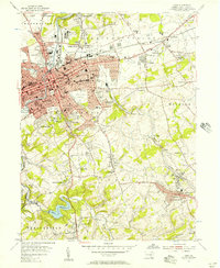
1954 Map of York
USGS Topo · Published 1957About this map
York serves as the bustling urban center of this mid-century Pennsylvania landscape, where the Codorus Creek flows past industrial sites and dense residential blocks. The 1950s era of suburban expansion is evident in the development of East York, Elmwood, and Wyndham Hills, while older rural signatures like Reynolds Mill on the York-East Branch and several quarries show the region's grounding in local industry. A network of country churches, including Stonybrook Ch and New Fairview Ch, anchors the surrounding townships of Springettsbury and York.
Find a feature on this map
102 named features on this map. Tap any name to fly to it.
Don’t see what you’re looking for? This feature index may not catch every label — zoom into the map to look around manually.
Map Details
Editions of this 1954 York Map
4 editions found
Other maps of this area

1906 · New Cumberland
USGS Topo · 1:62,500

1908 · Middletown
USGS Topo · 1:62,500

1908 · York
USGS Topo · 1:62,500

1910 · York
USGS Topo · 1:62,500

1920 · Hanover
USGS Topo · 1:62,500

1922 · Hanover
USGS Topo · 1:62,500

1943 · New Cumberland
USGS Topo · 1:62,500

1943 · Middletown
USGS Topo · 1:62,500

1948 · Baltimore
USGS Topo · 1:250,000

1950 · Harrisburg
USGS Topo · 1:250,000