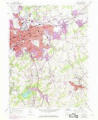
1954 Map of York
USGS Topo · Published 1969About this map
The industrial and residential growth of York and its sprawling suburbs is documented in this 1954 topographic survey, which includes extensive photorevisions from 1968. The city core, centered around Penn Common, is flanked by early rail corridors including the Penn Central and the MD & Pa lines. The landscape transitions from the urban density of North York and East York to the outlying boroughs of Dallastown and Yoe.
Find a feature on this map
98 named features on this map. Tap any name to fly to it.
Don’t see what you’re looking for? This feature index may not catch every label — zoom into the map to look around manually.
Map Details
Editions of this 1954 York Map
4 editions found
Other maps of this area

1906 · New Cumberland
USGS Topo · 1:62,500

1908 · Middletown
USGS Topo · 1:62,500

1908 · York
USGS Topo · 1:62,500

1910 · York
USGS Topo · 1:62,500

1920 · Hanover
USGS Topo · 1:62,500

1922 · Hanover
USGS Topo · 1:62,500

1943 · New Cumberland
USGS Topo · 1:62,500

1943 · Middletown
USGS Topo · 1:62,500

1948 · Baltimore
USGS Topo · 1:250,000

1950 · Harrisburg
USGS Topo · 1:250,000