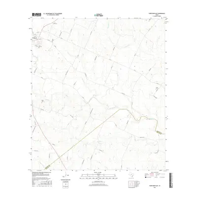
2016 Map of Yorktown East
USGS Topo · Published 2016About this map
Yorktown anchors the northwestern corner of this South Texas landscape, where residential streets like E Main St and S Nau St transition into a rural network of county roads. The area is notable for its high density of family and community burial grounds, including the Captain York Cem and Menn-Treude Cem, which offer significant genealogical value for researchers of DeWitt County families. The terrain is defined by a dendritic drainage pattern flowing toward the DeWitt and Goliad county line. Numerous named waterways, such as Fifteenmile Cr, Twelvemile Cr, and Shiloh Cr, carve through the countryside, dictating the placement of historic farm-to-market routes like FM 237 and FM 2718. This mapping reflects a land still deeply tied to its agricultural roots and ancestral homesteads.
Find a feature on this map
62 named features on this map. Tap any name to fly to it.
Don’t see what you’re looking for? This feature index may not catch every label — zoom into the map to look around manually.
Map Details
Editions of this 2016 Yorktown East Map
This is the sole edition of this map. No revisions or reprints were ever made.
Other maps of this area

1920 · Smiley
USGS Topo · 1:125,000

1953 · Beeville
USGS Topo · 1:250,000

1953 · Seguin
USGS Topo · 1:250,000

1956 · Beeville
USGS Topo · 1:250,000

1958 · Seguin
USGS Topo · 1:250,000

1960 · Beeville
USGS Topo · 1:250,000

1960 · Cuero
USGS Topo · 1:24,000

1960 · Blackwell Lake
USGS Topo · 1:24,000

1961 · New Davy
USGS Topo · 1:24,000

1963 · Meyersville
USGS Topo · 1:24,000