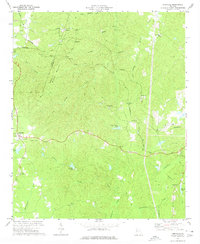
1973 Map of Yorkville
USGS Topo · Published 1975About this map
The boundary between Polk and Paulding counties runs through this rural North Georgia landscape, marked by the prominent ridge of Brushy Mountain and the heights of Braswell Mountain. The settlement of Braswell sits along the northern edge, where the Southern and Seaboard Coast Line rail lines intersect a terrain of winding creeks and wooded hills. This early 1970s survey captures the region's spiritual and social infrastructure through its many rural congregations, including Friendship Ch, Wayside Ch, and Mt Olivet Ch.
Find a feature on this map
42 named features on this map. Tap any name to fly to it.
Don’t see what you’re looking for? This feature index may not catch every label — zoom into the map to look around manually.
Map Details
Editions of this 1973 Yorkville Map
2 editions found
Other maps of this area

1886 · Rome
USGS Topo · 1:125,000

1889 · Tallapoosa
USGS Topo · 1:125,000

1890 · Cartersville
USGS Topo · 1:125,000

1891 · Marietta
USGS Topo · 1:125,000

1891 · Cartersville
USGS Topo · 1:125,000

1892 · Tallapoosa
USGS Topo · 1:125,000

1895 · Marietta
USGS Topo · 1:125,000

1896 · Cartersville
USGS Topo · 1:125,000

1897 · Marietta
USGS Topo · 1:125,000

1897 · Tallapoosa
USGS Topo · 1:125,000