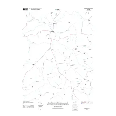
2013 Map of Yosemite
USGS Topo · Published 2013About this map
The Green River meanders through the heart of Casey County, anchoring a landscape defined by sharp ridges and deep hollows. The settlement of Middleburg sits near the river's northern bend, where Mill Dam Rd suggests an early reliance on water-driven industry. To the south, the community of Yosemite marks a central crossroads, while the ridge-bound Mount Olive overlooks the eastern edge of the quadrangle. High points like Meeting House Knob and Lawhorn Hill rise above the drainage networks of Knob Lick Cr and Hatter Cr, illustrating the rugged topography that has historically shaped local travel and property boundaries. Genealogists and local historians can trace family-named routes and landmarks such as King Cemetery Rd, Burdick Hollow, and Salyer Knob, which reflect the generations of families who established farms and homesteads across these hills.
Find a feature on this map
120 named features on this map. Tap any name to fly to it.
Don’t see what you’re looking for? This feature index may not catch every label — zoom into the map to look around manually.
Map Details
Editions of this 2013 Yosemite Map
This is the sole edition of this map. No revisions or reprints were ever made.
Other maps of this area

1935 · Somerset
USGS Topo · 1:62,500

1952 · Ellisburg
USGS Topo · 1:24,000

1952 · Halls Gap
USGS Topo · 1:24,000

1952 · Eubank
USGS Topo · 1:24,000

1952 · Hustonville
USGS Topo · 1:24,000

1952 · Liberty
USGS Topo · 1:24,000

1952 · Yosemite
USGS Topo · 1:24,000

1953 · Phil
USGS Topo · 1:24,000

1953 · Mintonville
USGS Topo · 1:24,000

1954 · Science Hill
USGS Topo · 1:24,000