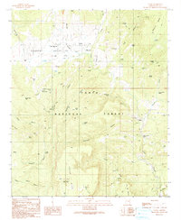
1990 Map of Young
USGS Topo · Published 1991About this map
Young and the surrounding Pleasant Valley define this landscape on the edge of the Tonto National Forest as it appeared in the late 20th century. The settlement pattern is centered around the Pleasant Valley Sch, a local Cem, and the Pleasant Valley Ranger Station, reflecting a community deeply integrated with the surrounding forest and ranching lands. Natural water sources and livestock infrastructure are densely mapped, including Cherry Creek, Walnut Creek, and numerous man-made tanks like Cochran Tank and Hog Canyon Tank.
Find a feature on this map
54 named features on this map. Tap any name to fly to it.
Don’t see what you’re looking for? This feature index may not catch every label — zoom into the map to look around manually.
Map Details
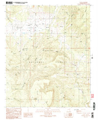
Editions of this 1990 Young Map
2 editions found
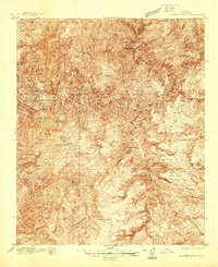
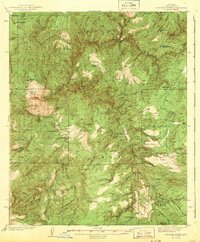
Other maps of this area

1886 · Holbrook
USGS Topo · 1:250,000

1887 · Verde
USGS Topo · 1:250,000

1892 · Verde
USGS Topo · 1:250,000

1893 · Holbrook
USGS Topo · 1:250,000

1907 · Roosevelt
USGS Topo · 1:125,000

1909 · Four Peaks
USGS Topo · 1:125,000

1912 · Roosevelt
USGS Topo · 1:125,000

1922 · Chrysotile
USGS Topo · 1:125,000
1937 · Diamond Butte
USGS Topo · 1:48,000
1943 · Diamond Butte
USGS Topo · 1:62,500