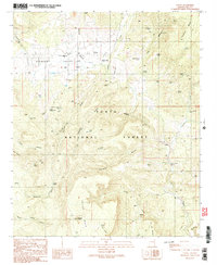
1990 Map of Young
USGS Topo · Published 1991About this map
Young serves as the focal point of this highland survey, situated within the broad expanse of Pleasant Valley and surrounded by the Tonto National Forest. The settlement's infrastructure is clearly defined, featuring the Pleasant Valley Sch, a Pleasant Valley Ranger Station, and a central Cem. The landscape is dominated by complex drainage systems and significant terrain features like Squaw Mesa and Squaw Peak. A network of water management features, including several Levees and numerous cattle tanks such as Hog Canyon Tank and Double Tank, illustrate the area's reliance on managed water sources for ranching. Transportation is primarily facilitated by a series of 4wd tracks and a dedicated Landing Strip, emphasizing the area's relative isolation. To the south, several isolated burial sites, labeled simply as Grave and Graveyard, reflect the long-standing occupation of this remote Arizona basin.
Find a feature on this map
59 named features on this map. Tap any name to fly to it.
Don’t see what you’re looking for? This feature index may not catch every label — zoom into the map to look around manually.
Map Details
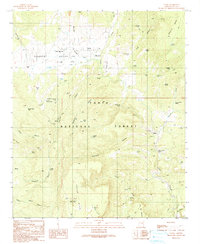
Editions of this 1990 Young Map
2 editions found
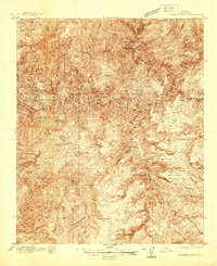
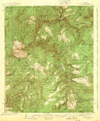
Other maps of this area

1886 · Holbrook
USGS Topo · 1:250,000

1887 · Verde
USGS Topo · 1:250,000

1892 · Verde
USGS Topo · 1:250,000

1893 · Holbrook
USGS Topo · 1:250,000

1907 · Roosevelt
USGS Topo · 1:125,000

1909 · Four Peaks
USGS Topo · 1:125,000

1912 · Roosevelt
USGS Topo · 1:125,000

1922 · Chrysotile
USGS Topo · 1:125,000
1937 · Diamond Butte
USGS Topo · 1:48,000
1943 · Diamond Butte
USGS Topo · 1:62,500