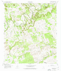
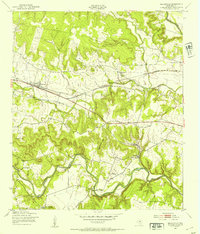
1958 Map of Youngsport
USGS Topo · Published 1974About this map
The Lampasas River carves a deep, winding path through the limestone uplands of Bell County in the late 1950s, creating a landscape defined by prominent overlooks and creek valleys. The small settlement of Youngsport sits near a significant bend in the river, serving as a focal point for the surrounding rural area. High points like Paisano Peak, Horse Thief Mountain, and Turnbow Mountain rise above the drainage basins of Stillman Valley Creek and Buttermilk Creek, illustrating the complex topography that dictated local road patterns and land use. Local landmarks including Cedar Knob Ch and Cedar Valley Ch anchor the community, while numerous water sources like Underwood Spring and Abbott Spring highlight the essential nature of natural springs for ranching and homesteads in this part of Texas. The map also traces the boundary between Bell Co and Williamson Co as it crosses the southern reaches near Rumsey Creek.
Find a feature on this map
25 named features on this map. Tap any name to fly to it.
Don’t see what you’re looking for? This feature index may not catch every label — zoom into the map to look around manually.
Map Details
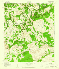
Editions of this 1958 Youngsport Map
4 editions found
Other maps of this area

1893 · Georgetown
USGS Topo · 1:125,000

1894 · Gatesville
USGS Topo · 1:125,000

1924 · Gatesville 4-d
USGS Topo · 1:48,000

1930 · Killeen
USGS Topo · 1:62,500

1947 · Fort Hood
USGS Topo · 1:62,500

1947 · Killeen
USGS Topo · 1:62,500

1947 · McMillan Mountains
USGS Topo · 1:24,000

1947 · Killeen
USGS Topo · 1:24,000
1947 · Nolanville
USGS Topo · 1:24,000

1954 · Waco
USGS Topo · 1:250,000