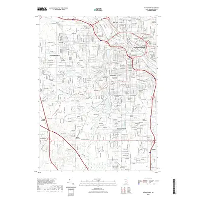
2019 Map of Youngstown
USGS Topo · Published 2019About this map
The Mahoning River carves through the center of this industrial and urban corridor, where the B & O RR and major thoroughfares connect established neighborhoods like Brier Hill, Fosterville, and the South Side. The landscape is a complex mix of dense residential blocks, civic landmarks such as the Mahoning County Courthouse, and expansive green spaces including Idora Park and Forest Lawn Memorial Park. Along the river valley, the geography is defined by narrow runs and ponds, most notably Lake Cohasset and the Lily Pond, which provide a distinct natural break in the grid of Youngstown.
Find a feature on this map
299 named features on this map. Tap any name to fly to it.
Don’t see what you’re looking for? This feature index may not catch every label — zoom into the map to look around manually.
Map Details
Editions of this 2019 Youngstown Map
This is the sole edition of this map. No revisions or reprints were ever made.
Other maps of this area

1906 · Youngstown
USGS Topo · 1:62,500

1907 · Columbiana
USGS Topo · 1:62,500

1908 · Youngstown
USGS Topo · 1:62,500

1908 · Warren
USGS Topo · 1:62,500

1909 · Lisbon
USGS Topo · 1:62,500

1909 · Columbiana
USGS Topo · 1:62,500

1950 · Cleveland
USGS Topo · 1:250,000

1951 · Canton
USGS Topo · 1:250,000

1951 · Columbiana
USGS Topo · 1:24,000

1951 · Campbell
USGS Topo · 1:24,000