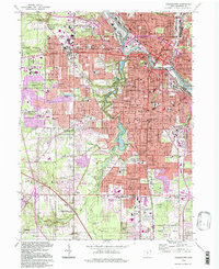
1994 Map of Youngstown
USGS Topo · Published 1997About this map
The Mahoning River carves through the industrial and urban heart of Youngstown, revealing a dense grid of neighborhoods including Brier Hill, Wickliffe, and Austintown. This mid-1990s landscape is defined by its institutional and recreational anchors, from the sprawling campus of Youngstown State University to the extensive green corridor of Mill Creek Park. The park system, following Mill Creek, creates a distinct chain of waterways including Lake Glacier, Lake Cohasset, and Lake Newport, offering a sharp contrast to the surrounding residential and commercial zones.
Find a feature on this map
98 named features on this map. Tap any name to fly to it.
Don’t see what you’re looking for? This feature index may not catch every label — zoom into the map to look around manually.
Map Details
Editions of this 1994 Youngstown Map
This is the sole edition of this map. No revisions or reprints were ever made.
Other maps of this area

1906 · Youngstown
USGS Topo · 1:62,500

1907 · Columbiana
USGS Topo · 1:62,500

1908 · Youngstown
USGS Topo · 1:62,500

1908 · Warren
USGS Topo · 1:62,500

1909 · Lisbon
USGS Topo · 1:62,500

1909 · Columbiana
USGS Topo · 1:62,500

1950 · Cleveland
USGS Topo · 1:250,000

1951 · Canton
USGS Topo · 1:250,000

1951 · Columbiana
USGS Topo · 1:24,000

1951 · Campbell
USGS Topo · 1:24,000