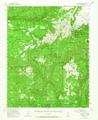
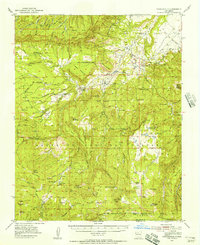
1953 Map of Youngsville
USGS Topo · Published 1965About this map
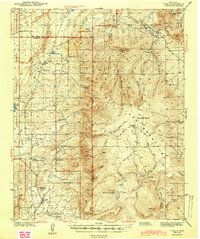
Youngsville and the surrounding high-country settlements of the Santa Fe National Forest are defined here by a mix of timber industry and ranching during the mid-1950s. The landscape is dominated by expansive mesas, including Mesa Poleo and Mesa Pinabetal, each served by its own local schoolhouse. This era captured a transition in the local timber economy, shown by the active Muscaranes Sawmill and the nearby Upper Coyote Creek Sawmill (Abandoned). Local religious and civic life centers on the Santa Teresa Church and the Coyote Ranger Station near the village of Coyote. The terrain is marked by distinctive geological features like Teakettle Rock and the prominent Cerro Pedernal, while the northern portion of the quadrangle includes the historical boundaries of the Piedra Lumbre Grant. A network of pack trails and jeep trails connects remote outposts like La Grulla Ranch to the primary settlements along the Rio Puerco.
Find a feature on this map
70 named features on this map. Tap any name to fly to it.
Don’t see what you’re looking for? This feature index may not catch every label — zoom into the map to look around manually.
Map Details
Editions of this 1953 Youngsville Map
2 editions found
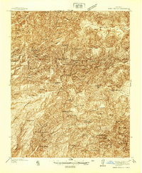
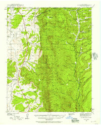
Other maps of this area

1890 · Jemes
USGS Topo · 1:125,000

1892 · Jemes
USGS Topo · 1:125,000

1892 · Santa Clara
USGS Topo · 1:125,000

1909 · Gallina
USGS Topo · 1:125,000

1918 · Abiquiu
USGS Topo · 1:125,000
1937 · Jemez Springs
USGS Topo · 1:48,000
1939 · La Ventana
USGS Topo · 1:62,500

1940 · Cuba
USGS Topo · 1:62,500
1943 · Cuba
USGS Topo · 1:62,500

1943 · La Ventana
USGS Topo · 1:62,500