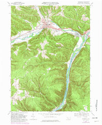
1969 Map of Youngsville
USGS Topo · Published 1982About this map
Youngsville serves as the focal point of this 1960s landscape, situated where Brokenstraw Creek winds through the valley to meet the Allegheny River. The area's mid-century infrastructure is well-defined, featuring the Conrail lines that parallel the water and the County Home and Hospital located just east of the main settlement. Further south, the map reveals a more secluded character as the terrain rises into the State Game Lands No 86 and the Allegheny National Forest, where smaller settlements like Althom and Allegheny Springs are found. The presence of an Oil Field and a Gravel Pit indicates the region's reliance on natural resource extraction. Local landmarks, including St Lukes Ch, the High Sch, and the Buckaloons Recreation Area at the confluence of the river and creek, offer specific points of interest for those studying the community's historical layout.
Find a feature on this map
50 named features on this map. Tap any name to fly to it.
Don’t see what you’re looking for? This feature index may not catch every label — zoom into the map to look around manually.
Map Details
Editions of this 1969 Youngsville Map
4 editions found
Other maps of this area

1906 · Warren
USGS Topo · 1:62,500

1907 · Warren
USGS Topo · 1:62,500

1908 · Warren
USGS Topo · 1:62,500

1926 · Youngsville
USGS Topo · 1:62,500

1927 · Tidioute
USGS Topo · 1:48,000

1929 · Youngsville
USGS Topo · 1:62,500

1930 · Tidioute
USGS Topo · 1:62,500

1935 · Sheffield
USGS Topo · 1:48,000

1941 · Sheffield
USGS Topo · 1:62,500

1943 · Youngsville
USGS Topo · 1:62,500