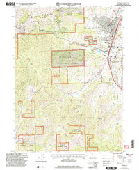
2001 Map of Yreka
USGS Topo · Published 2004About this map
Yreka and its surrounding mountain landscapes are detailed in this survey from the start of the 21st century, showing the established layout of the Siskiyou County Courthouse and nearby Siskiyou County Fairgrounds. The map documents a town defined by its gold-mining heritage, with extensive Dredge Tailings visible along Greenhorn Creek and Humbug Gulch. The northern settlement of Hawkinsville remains distinct, while industrial features like the Scorpion Mine and several gravel pits dot the high ground. To the south and west, the landscape transitions into the steep terrain of the Klamath National Forest, where peaks like Montana Peak and Bally Mountain overlook a complex network of drainages including Soap Creek and Juniper Creek. Local community spaces are well-represented, from the Evergreen Cemetery to recreational areas like Discovery Park and Greenhorn Park bordering the Greenhorn Reservoir.
Find a feature on this map
52 named features on this map. Tap any name to fly to it.
Don’t see what you’re looking for? This feature index may not catch every label — zoom into the map to look around manually.
Map Details
Editions of this 2001 Yreka Map
2 editions found
Other maps of this area

1886 · Shasta
USGS Topo · 1:250,000

1894 · Shasta
USGS Topo · 1:250,000

1922 · Shasta Valley Sheet No 3
USGS Topo · 1:24,000

1922 · Shasta Valley Sheet No 3 S
USGS Topo · 1:24,000

1932 · Yreka
USGS Topo · 1:96,000

1939 · Yreka
USGS Topo · 1:125,000

1948 · Weed
USGS Topo · 1:250,000

1950 · Weed
USGS Topo · 1:250,000

1954 · Yreka
USGS Topo · 1:62,500

1955 · Condrey Mtn
USGS Topo · 1:62,500