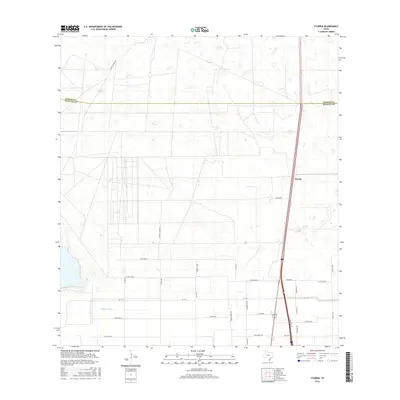
2016 Map of Yturria
USGS Topo · Published 2016About this map
Yturria stands as a focal point in this South Texas landscape, situated along the major transportation corridor that parallels the N Frontage Rd. This 2016 survey illustrates a transition between the more structured road networks of the southern half and the less developed terrain to the north. The boundary between Kenedy Co and Willacy Co bisects the quadrangle, marking a administrative divide through an area characterized by family-named routes and ranching heritage. Several locally significant thoroughfares, such as Garcia Ranch Rd and Simon Gomez Rd, hint at the ancestral property lines and settlements that have shaped this portion of Willacy County. Water management is evidenced by the presence of the W Main Drain, while the inclusion of Cemetery Rd on the eastern edge provides a specific point of interest for those researching local family history and rural burial sites.
Find a feature on this map
33 named features on this map. Tap any name to fly to it.
Don’t see what you’re looking for? This feature index may not catch every label — zoom into the map to look around manually.
Map Details
Editions of this 2016 Yturria Map
This is the sole edition of this map. No revisions or reprints were ever made.
Other maps of this area

1921 · Tarida Ranch
USGS Topo · 1:62,500

1922 · La Sal Vieja
USGS Topo · 1:62,500

1953 · Brownsville
USGS Topo · 1:250,000

1956 · Rudolph
USGS Topo · 1:24,000

1956 · Andrea Ranch
USGS Topo · 1:24,000

1956 · San Perlita South
USGS Topo · 1:24,000

1956 · Rosita Lake
USGS Topo · 1:24,000

1956 · La Sal Vieja
USGS Topo · 1:24,000

1956 · San Perlita North
USGS Topo · 1:24,000

1956 · Yturria
USGS Topo · 1:24,000