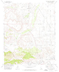
1972 Map of Yucca Valley North
USGS Topo · Published 1975About this map
Flamingo Heights and Pioneertown occupy a high-desert landscape defined by stark geological formations and sprawling alluvial basins in the early 1970s. The map illustrates a transitional period for this part of the Mojave, where traditional homesteading efforts meet modern residential expansion. The massive volcanic landmark of Black Lava Butte and the broad plateau of Flat Top dominate the northwestern sector, while Homestead Mesa to the east shows the characteristic grid of land division that shaped early settlement. Following the natural drainage patterns of Pipes Wash, the local infrastructure relies on key desert thoroughfares like Old Woman Springs Road. This survey documents the mid-century growth of Yucca Valley, capturing the exact placement of early homes and desert roads before the intensification of suburban development in the region.
Find a feature on this map
8 named features on this map. Tap any name to fly to it.
Don’t see what you’re looking for? This feature index may not catch every label — zoom into the map to look around manually.
Map Details
Editions of this 1972 Yucca Valley North Map
4 editions found
Other maps of this area

1901 · Southern California Sheet No. 1
USGS Topo · 1:250,000

1902 · San Gorgonio
USGS Topo · 1:125,000

1904 · Southern California Sheet No. 1
USGS Topo · 1:250,000

1953 · San Bernardino
USGS Topo · 1:250,000

1955 · Goat Mountain
USGS Topo · 1:24,000

1955 · Old Woman Springs
USGS Topo · 1:62,500

1955 · Emerson Lake
USGS Topo · 1:62,500

1955 · Morongo Valley
USGS Topo · 1:62,500

1955 · Joshua Tree
USGS Topo · 1:62,500

1956 · San Bernardino
USGS Topo · 1:250,000