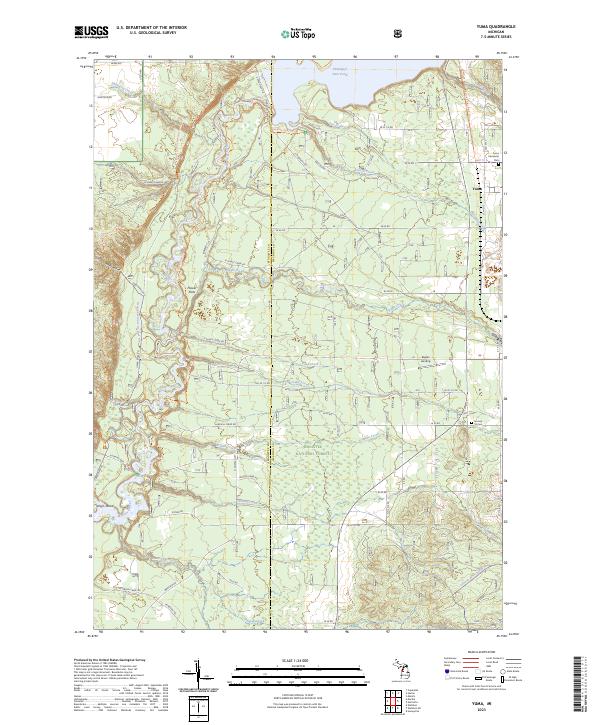
2023 Map of Yuma
USGS Topo · Published 2023About this map
The Manistee River winds through the heart of the Manistee National Forest in this survey of northwest Michigan, where the rugged terrain of Sweets Ravine meets the managed waters of the Hodenpyl Dam Pond. This landscape is defined by its recreation and forestry heritage, with the North Country National Scenic Trail traversing the woodlands and wetlands. The small settlement of Yuma sits near the eastern boundary, accompanied by the Yuma Memorial Park and the historic Section 16 Cem. Numerous tributaries, including Slagle Creek, Dead Creek, and Arquilla Creek, carve through the forest, while specialized access like the Newaygo-Weldon Smt Dwnhl Trl points to the area's modern use for outdoor sports. Small clearings such as Flower Flats and Eagles Landing provide rare breaks in the dense canopy along the river corridor.
Find a feature on this map
71 named features on this map. Tap any name to fly to it.
Don’t see what you’re looking for? This feature index may not catch every label — zoom into the map to look around manually.
Map Details
Editions of this 2023 Yuma Map
This is the sole edition of this map. No revisions or reprints were ever made.
Other maps of this area

1933 · Peacock NE
USGS Topo · 1:31,680

1933 · Luther NW
USGS Topo · 1:31,680

1933 · Peacock NW
USGS Topo · 1:31,680

1954 · Traverse City
USGS Topo · 1:250,000

1956 · Mesick
USGS Topo · 1:62,500

1957 · Copemish
USGS Topo · 1:62,500

1957 · Luther
USGS Topo · 1:62,500

1957 · Wellston
USGS Topo · 1:62,500

1958 · Traverse City
USGS Topo · 1:250,000
1976 · Wellston NE
USGS Topo · 1:24,000
Featured Places
- Norman Township, MI
- Dickson Township, MI
- Marilla Township, MI
- Slagle Township, MI
- Springville Township, MI