1993 Map of Yuma
USGS Topo · Published 1993About this map
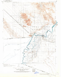
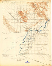
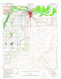
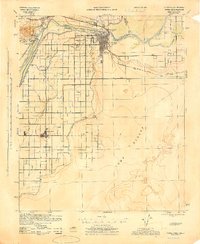
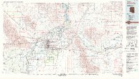
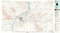
The Colorado River serves as the central artery of this 1993 edition, where the borders of Arizona, California, and Mexico converge. This intersection of geography is anchored by Yuma, a major regional hub defined by its complex irrigation and transportation infrastructure. Significant water management features like the All-American Canal, Gila Gravity Main Canal, and Imperial Reservoir dominate the landscape, illustrating the engineering required to sustain agriculture in the Yuma Desert. The map details various settlements from Somerton to Gadsden, alongside major military and institutional sites including the US Marine Corps Air Station and Arizona Western College. To the north and east, the topography rises sharply into the Chocolate Mountains and Muggins Mountains, while the Fort Yuma Indian Reservation and Cocopah Indian Reservation mark historical land use patterns near the river.
Find a feature on this map
62 named features on this map. Tap any name to fly to it.
Don’t see what you’re looking for? This feature index may not catch every label — zoom into the map to look around manually.
Map Details
Editions of this 1993 Yuma Map
2 editions found
Historical Maps of Yuma Through Time
6 maps found