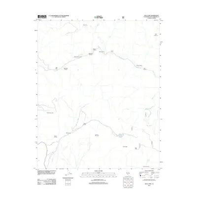
2012 Map of Zaca Lake
USGS Topo · Published 2012About this map
Zaca Lake serves as a focal point in this mountainous section of Santa Barbara County, where the terrain is defined by a complex network of canyons and ridges. The Sisquoc River carves a path through the northern landscape, joined by numerous drainages such as Wildhorse Canyon, Rattlesnake Canyon, and Bee Rock Canyon. Human presence is marked by small outposts and recreational sites like Pickett Corral, Tunnel Ranch, and Honeymoon Flat, suggesting a history of ranching and early backcountry access.
Find a feature on this map
36 named features on this map. Tap any name to fly to it.
Don’t see what you’re looking for? This feature index may not catch every label — zoom into the map to look around manually.
Map Details
Editions of this 2012 Zaca Lake Map
This is the sole edition of this map. No revisions or reprints were ever made.
Other maps of this area

1902 · Santa Ynez
USGS Topo · 1:125,000

1905 · Santa Ynez
USGS Topo · 1:125,000

1905 · Lompoc
USGS Topo · 1:125,000

1941 · San Rafael Mtn.
USGS Topo · 1:62,500

1941 · McPherson Peak
USGS Topo · 1:62,500

1942 · Lompoc
USGS Topo · 1:125,000

1942 · San Rafael Mtn.
USGS Topo · 1:62,500

1942 · Tepusquet Peak
USGS Topo · 1:62,500

1942 · Los Olivos
USGS Topo · 1:62,500

1943 · San Rafael Mtn.
USGS Topo · 1:62,500