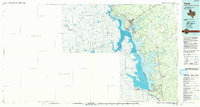
1985 Map of Zapata
USGS Topo · Published 1985About this map
Falcon Reservoir dominates this South Texas landscape, where the waters of the Rio Grande are impounded along the international border. This mid-1980s data highlights the cross-border geography, contrasting the organized grid of Zapata and the developing residential clusters of Siesta Shores and Las Palmas with the historical footprint of Nueva Ciudad Guerrero on the Mexico side. The map traces the critical infrastructure of the era, from the Falcon Dam and its associated Powerhouse to the primary transit corridor of Us 83.
Find a feature on this map
47 named features on this map. Tap any name to fly to it.
Don’t see what you’re looking for? This feature index may not catch every label — zoom into the map to look around manually.
Map Details
Editions of this 1985 Zapata Map
2 editions found
Other maps of this area

1938 · Falcon
USGS Topo · 1:62,500

1938 · El Sauz
USGS Topo · 1:62,500

1938 · Cuevitas
USGS Topo · 1:62,500

1939 · Randado
USGS Topo · 1:62,500

1940 · Randado
USGS Topo · 1:62,500

1940 · Mogotes Hill
USGS Topo · 1:62,500

1942 · San Ygnacio
USGS Topo · 1:62,500

1949 · Mc Allen
USGS Topo · 1:250,000

1954 · McAllen
USGS Topo · 1:250,000

1956 · Mogotes Hill
USGS Topo · 1:62,500