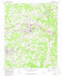
1968 Map of Zebulon
USGS Topo · Published 1982About this map
Zebulon serves as the focal point of this Eastern North Carolina landscape, where the Norfolk Southern railroad cuts through the heart of the settlement. The map illustrates the town's growth alongside established rural communities like Wakefield and the curiously named Lizard Lick. Educational landmarks such as Wakelon High Sch and Shepard High Sch are clearly marked, reflecting the local civic infrastructure of the 1960s and early 1980s.
Find a feature on this map
38 named features on this map. Tap any name to fly to it.
Don’t see what you’re looking for? This feature index may not catch every label — zoom into the map to look around manually.
Map Details
Editions of this 1968 Zebulon Map
3 editions found
Other maps of this area

1902 · Kenly
USGS Topo · 1:62,500

1902 · Spring Hope
USGS Topo · 1:62,500

1903 · Kenly
USGS Topo · 1:62,500

1904 · Springhope
USGS Topo · 1:62,500

1953 · Raleigh
USGS Topo · 1:250,000

1954 · Raleigh
USGS Topo · 1:250,000

1964 · Flowers
USGS Topo · 1:24,000

1964 · Selma
USGS Topo · 1:62,500

1964 · Clayton
USGS Topo · 1:24,000

1967 · Knightdale
USGS Topo · 1:24,000