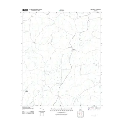
2012 Map of Zeiglerville
USGS Topo · Published 2012About this map
Zeiglerville and the surrounding Yazoo County countryside are defined by a network of rural roads and creek drainages in this 2012 topographic record. The landscape is dotted with small family and community burial grounds, including Brantley Cem, Riley Cem, and Tolar Cem, which serve as vital landmarks for local genealogy. Waterways such as Tesheva Cr and Harland Cr carve through the terrain, influencing the layout of local thoroughfares like Ebenezer Coxburg Rd and Saint Luke Church Rd. Small rural centers like Coxburg and Midway anchor the northern and southern portions of the map, respectively, while the intersection at Pierce Crossroad marks the southwestern boundary. The distribution of properties and names like Swayze Home Place Rd and Johnson Quarters Rd provides insight into the historical land ownership and residential patterns of this Mississippi region.
Find a feature on this map
59 named features on this map. Tap any name to fly to it.
Don’t see what you’re looking for? This feature index may not catch every label — zoom into the map to look around manually.
Map Details
Editions of this 2012 Zeiglerville Map
This is the sole edition of this map. No revisions or reprints were ever made.
Other maps of this area

1940 · Lexington
USGS Topo · 1:62,500

1940 · Mileston
USGS Topo · 1:62,500

1953 · Greenwood
USGS Topo · 1:250,000

1954 · Mileston
USGS Topo · 1:62,500

1955 · Jackson
USGS Topo · 1:250,000

1956 · Greenwood
USGS Topo · 1:250,000

1957 · Lexington
USGS Topo · 1:62,500

1958 · Lexington
USGS Topo · 1:62,500

1961 · Jackson
USGS Topo · 1:250,000

1961 · Valley
USGS Topo · 1:62,500