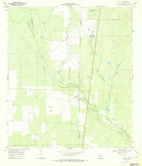
1968 Map of Zella
USGS Topo · Published 1972About this map
The tiny settlement of Zella and the Esperanza Ranch define this pocket of South Texas during the late 1960s. Located on the boundary where La Salle Co and McMullen Co meet, the landscape is shaped by a network of seasonal watercourses, including Rawhide Creek, El Sauz Creek, and Maguey Creek. These drainages feed into the larger Esperanza Creek, which snakes across the lower half of the quadrangle. The economy of the era is evidenced by scattered Gravel Pits and various Well and Windmill sites, indicating a reliance on groundwater and extractive industry in a dry brushland environment. The map captures the area just as State Route 97 facilitated regional transit through this ranching territory, providing a precise record of fence lines and unimproved roads that served local estates.
Find a feature on this map
11 named features on this map. Tap any name to fly to it.
Don’t see what you’re looking for? This feature index may not catch every label — zoom into the map to look around manually.
Map Details
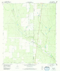
Editions of this 1968 Zella Map
2 editions found
Other maps of this area

1930 · Tilden
USGS Topo · 1:62,500

1942 · Fowlerton
USGS Topo · 1:62,500

1942 · Tilden
USGS Topo · 1:62,500

1953 · Crystal City
USGS Topo · 1:250,000

1955 · Crystal City
USGS Topo · 1:250,000

1956 · Hindes
USGS Topo · 1:62,500

1956 · Franklin Settlement
USGS Topo · 1:62,500

1956 · Fowlerton
USGS Topo · 1:62,500

1961 · Crystal City
USGS Topo · 1:250,000

1968 · Crystal City
USGS Topo · 1:250,000