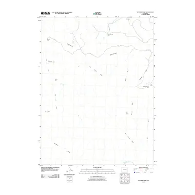
2010 Map of Zenobia Peak
USGS Topo · Published 2010About this map
Douglas Mountain dominates this high-altitude landscape in Moffat County, where the topography is defined by a complex network of draws and valleys. The map documents an area deeply tied to resource extraction and remote ranching, featuring the Queen Anne and Black Sioux Mine to the west and the Douglas Mountain Mine near Peterson Valley in the east. These labels, along with the Paint Iron Mine, point to the area's geological significance and mining history.
Find a feature on this map
24 named features on this map. Tap any name to fly to it.
Don’t see what you’re looking for? This feature index may not catch every label — zoom into the map to look around manually.
Map Details
Editions of this 2010 Zenobia Peak Map
This is the sole edition of this map. No revisions or reprints were ever made.
Other maps of this area

1907 · Rangely
USGS Topo · 1:125,000

1910 · Rangely
USGS Topo · 1:125,000

1954 · Hells Canyon
USGS Topo · 1:24,000

1954 · Canyon of Lodore South
USGS Topo · 1:24,000

1954 · Canyon of Lodore North
USGS Topo · 1:24,000

1954 · Vernal
USGS Topo · 1:250,000

1958 · Vernal
USGS Topo · 1:250,000

1960 · Vernal
USGS Topo · 1:250,000

1962 · Tanks Peak
USGS Topo · 1:24,000
1962 · Haystack Rock
USGS Topo · 1:24,000