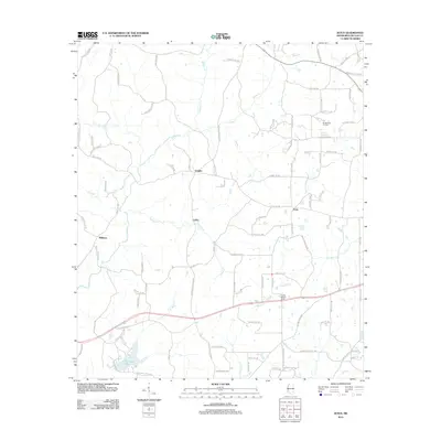
2012 Map of Zetus
USGS Topo · Published 2012About this map
The Brookhaven Oil Field anchors the northeast corner of this rural landscape in Lincoln County, where the petroleum industry and timberlands define the local economy. Small residential clusters like Zetus, Vaughn, and Cobbs are connected by a dense network of local roads such as Zetus Rd NW and Progress Trl NW. The terrain is characterized by a high frequency of minor waterways, including the winding McCall Cr, Beaver Cr, and Shaws Cr, which drain into larger features like Hurricane Lake in the southwest. A notable landmark for regional monitoring is the Lincoln Lookout Tower, situated near Butler Cr. This detailed survey provides a view of the area's rural development and industrial footprint just after the first decade of the 21st century.
Find a feature on this map
101 named features on this map. Tap any name to fly to it.
Don’t see what you’re looking for? This feature index may not catch every label — zoom into the map to look around manually.
Map Details
Editions of this 2012 Zetus Map
This is the sole edition of this map. No revisions or reprints were ever made.
Other maps of this area

1953 · Natchez
USGS Topo · 1:250,000

1956 · Natchez
USGS Topo · 1:250,000

1959 · Natchez
USGS Topo · 1:250,000

1972 · West Lincoln
USGS Topo · 1:24,000

1972 · Midway
USGS Topo · 1:24,000

1972 · McCall Creek
USGS Topo · 1:24,000

1972 · Little Springs
USGS Topo · 1:24,000

1972 · Caseyville
USGS Topo · 1:24,000

1972 · Bogue Chitto
USGS Topo · 1:24,000

1972 · Brookhaven
USGS Topo · 1:24,000