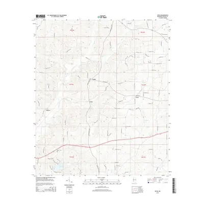
2015 Map of Zetus
USGS Topo · Published 2015About this map
Vaughn and the surrounding timberlands of Lincoln County are defined by a complex web of tributaries feeding into the Homochitto River system. In the mid-2010s, this landscape shows a pattern of rural clusters at Cobbs and Zetus, where local life is oriented around the crossings of Zetus Rd NW and Jackson Liberty Dr NW. The terrain is deeply etched by watercourses like McCall Creek, Blue Cr, and Beaver Cr, which dictate the winding paths of rural roads like Cantaloupe Ln NW and Oil Field Ln NW. Genealogists may find value in the location of the Pleasant Grove Cem near the southern boundary, while the presence of Hurricane Lake and Hurricane Cr highlights the low-lying drainage basins that dominate the southwestern portion of the quadrangle.
Find a feature on this map
93 named features on this map. Tap any name to fly to it.
Don’t see what you’re looking for? This feature index may not catch every label — zoom into the map to look around manually.
Map Details
Editions of this 2015 Zetus Map
This is the sole edition of this map. No revisions or reprints were ever made.
Other maps of this area

1953 · Natchez
USGS Topo · 1:250,000

1956 · Natchez
USGS Topo · 1:250,000

1959 · Natchez
USGS Topo · 1:250,000

1972 · West Lincoln
USGS Topo · 1:24,000

1972 · Midway
USGS Topo · 1:24,000

1972 · McCall Creek
USGS Topo · 1:24,000

1972 · Little Springs
USGS Topo · 1:24,000

1972 · Caseyville
USGS Topo · 1:24,000

1972 · Bogue Chitto
USGS Topo · 1:24,000

1972 · Brookhaven
USGS Topo · 1:24,000