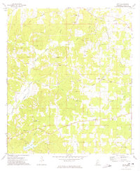
1972 Map of Zetus
USGS Topo · Published 1974About this map
The Brookhaven Oil Field dominates the eastern landscape of this early 1970s survey, illustrating the industrial footprint of petroleum extraction in Lincoln County. The land is marked by numerous Gravel Pits and a winding network of watercourses including Mc Call Creek, Beaver Creek, and the southern Hurricane Lake. A significant historical Treaty Boundary cuts across the northern terrain, indicating old land divisions that predated the established settlement patterns of communities like Zetus, Vaughn, and Cobbs.
Find a feature on this map
38 named features on this map. Tap any name to fly to it.
Don’t see what you’re looking for? This feature index may not catch every label — zoom into the map to look around manually.
Map Details
Editions of this 1972 Zetus Map
This is the sole edition of this map. No revisions or reprints were ever made.
Other maps of this area

1953 · Natchez
USGS Topo · 1:250,000

1956 · Natchez
USGS Topo · 1:250,000

1959 · Natchez
USGS Topo · 1:250,000

1972 · West Lincoln
USGS Topo · 1:24,000

1972 · Midway
USGS Topo · 1:24,000

1972 · McCall Creek
USGS Topo · 1:24,000

1972 · Little Springs
USGS Topo · 1:24,000

1972 · Caseyville
USGS Topo · 1:24,000

1972 · Bogue Chitto
USGS Topo · 1:24,000

1972 · Brookhaven
USGS Topo · 1:24,000